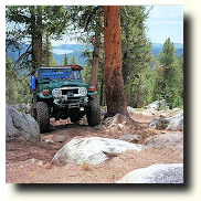
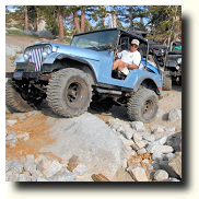
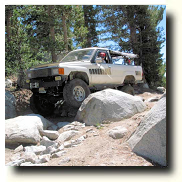
Off Road Trails
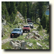
Off-Highway Vehicle (OHV) users will find many opportunities for off-highway enjoyment in the Sierra National Forest. Become familiar with OHV laws, restrictions, and closures. Respect private property, wildlife and other forest visitors. Always operate your vehicle in a safe, responsible manner.
OFF-HIGHWAY VEHICLE PERMIT AND REGISTRATION REQUIREMENTS
All vehicles which are operated on public lands must be registered with the Department of Motor Vehicles (DMV). The registration fee is $50 per vehicle, and is valid for a two-year period. The OHV fees are used for acquisition of new OHV areas, development and operation of existing OHV areas, enforcement of the rules and regulations, and protection of the natural resources. DMV will issue a Green or Red Sticker for off-road vehicles. Vehicles which can be operated both on- and off-highway will be given a street-legal license.
In order to operate any type of motorized vehicle off-road on public land, you must have one of the following:
Street-Legal License Plate: If you want to operate a 4-wheel drive vehicle or dual-purpose motorcycle on-road and off-road, you must have a street-legal license plate.
The Green Sticker Or Red Sticker: If you are going to operate a motorized vehicle off-road only, you must have either a Green Sticker or a Red Sticker that has been issued by the Department of Motor Vehicles. The Green Sticker allows vehicles to operate on public land all year. The Red Sticker is for motorcycles and ATVs model year 2003 and newer that do not meet the emission standards established by the California Air Resources Board. If the vehicle has a 3 or a C in the eighth position of the Vehicle Identification Number, then it does not meet the emission standards and should be issued a Red Sticker. The Red Sticker is exactly the same as the Green Sticker except that these vehicles can only be operated during certain times of the year. To find out when you can operate your vehicle, call the specific riding area that you want to visit or you can follow the link to the Red Sticker Open Riding Schedule.
Vehicles Without VIN Numbers
A Green Sticker or street legal license is required to drive in the Sierra National Forest. In order to get a permit your vehicle must have a VIN (vehicle identification number). If your vehicle does not have a VIN you can contact the California Highway Patrol Office for an evaluation. Not every vehicle will meet the requirements, but not every vehicle is made for use on public lands such as national forests, state beaches, deserts.
MULTIPLE USE
Many people with different interests may be enjoying an area at the same time. Trail and camping courtesy are essential for everyone to have an enjoyable experience. Be a good neighbor and extend the same courtesy and consideration to those around you as you expect from them. If you are using a Off-Highway Vehicle please follow the rules below when using trails:
Motorcycles Yield to All
Bicycles Yield to Equestrians and Hikers
Hikers Yield to Equestrians
ORGANIZED EVENTS
The use of National Forest Lands for organized recreation events, such as enduros, poker runs, and rallies, requires a Special Use Permit. Contact the District Office responsible for the administration of the area for details and requirements. RIDING OPPORTUNITIES
The Sierra National Forest offers a variety of trail riding experiences. In general, off-highway vehicles can operate on any road or trail that is designated with a OHV marker ( a jeep symbol). California Vehicle Code and Green Sticker laws apply on all National Forest roads.
Below you will find various recommended OHV opportunities on the Sierra National Forest. Courtright/Wishon Area
Dusy-Ershim OHV Route: This backcountry route is classified as Most Difficult and traverses 31 miles between the John Muir and Dinkey Wilderness areas. Driving time for the entire route is 2 to 3 days. This route is recommended for advanced drivers, and not recommended for full size pickups, long wheel base vehicles or for traveling alone.
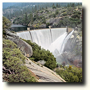
To get there take Hwy 168 east of Clovis to the Dinkey Creek Road (just before you get to Shaver Lake). Follow the Dinkey Creek Road east to Dinkey Creek. At Dinkey Creek take the McKinley Grove Road toward Courtright Reservoir. At the Courtright Road, turn left and head north towards Courtright Reservoir. Cross the dam on the east side of the lake and stay on the road to the Dusy-Ershim OHV route sign.
The route begins at 8,400 feet elevation, with many open rocky areas. Be aware that portions of the trail cross large granite slabs and are marked with rocks. Elevation rises to 10,000 feet at Thompson Lake, remaining at the 9,000 to 10,000 feet for the rest of the route.
Spanish OHV Route: This route is classified as More Difficult. An easy route for experienced drivers and a challenge for beginning drivers. The route encompasses loose dirt, some granite, a few rocks, and a little uphill. The route is 3.5 miles long and takes 4 hours to drive. This route is not recommended for van type 4WD vehicles or full size pickups, due to some tight maneuvering near the wilderness boundary.
To get there take Hwy 168 east of Clovis to the Dinkey Creek Road (just before your get to Shaver Lake). Follow the Dinkey Creek Road east to Dinkey Creek. At Dinkey Creek take the McKinley Grove Road 17 miles to Wishon Dam. Follow the road 2.5 miles past the Dam and turn at the Crown Valley Trailhead. Follow the road 1.5 miles to the Spanish Route, it starts a short distance beyond Rancheria Creek. Dinkey Creek
Swamp OHV Route: For the experienced drivers. Long wheel base vehicles recommended only from Exchequer Meadow to Hatch Lake trail junction. The route is approximately 9 miles and takes 4.5 hours to drive.
To get there take Hwy 168 east of Clovis to the Dinkey Creek Road (just before your get to Shaver Lake). Follow the Dinkey Creek Road east to Dinkey Creek. At Dinkey Creek turn on the McKinley Grove Road. Travel 2.5 miles to the Swamp Lake Vehicle Route. Turn north and follow the dirt road 3 miles to the fork in the road. At the fork, turn left and drive 1.1 miles until it forks again. Take the left fork .8 miles to the trailhead gate.
There are several OHV routes located near Edison and Florence lakes. To get there take Highway 168 east from Clovis to Huntington Lake. At Huntington Lake take the Kaiser Pass Road east to the junction of the roads that take you to Edison or Florence Lakes. The routes include:
Hooper Diversion: This route is 2.5 miles long and is classified as Easiest. It takes 2 hours to drive. This route is located off of the Florence Lake Road (7S01). Follow 7S01 for 5.5 miles to road 7S65, turn left and travel to the Jackass Meadow Campground. Continue for another 2 miles to reach Hooper Diversion Dam.
Bear Diversion: This route is 2 miles long and is classified as Easiest. It takes 1 hour to drive. This route is located off of the Edison Lake Road (5S80). Follow 5S80 two miles north past Mono Hot Springs and continue another mile to the intersection with road 6S38. Turn right on 6S38 and follow the route 2 miles to Bear Diversion Dam.
This is a popular starting point for people who want to enter the John Muir Wilderness. Overnight stays in the wilderness require a permit. Day trips do not require a permit.
Onion Springs: This route is 5 miles long and is classified as Easiest. It takes 2 hours to drive. The route is located near Edison Lake. Take road (5S80) to road 6S83. Follow road 6S83 for three miles to Edison Lake. Turn left and drive across Vermillion Valley Dam for 3 miles to the Onion Springs OHV route. This route serves as a trailhead to the John Muir Wilderness. Huntington Lake
Just south of Huntington Lake, off of Hwy 168, you will find the Red Mountain OHV routes. There are several routes in the area that lead to small lakes near or in the Dinkey Lakes Wilderness. They include West Lake, Strawberry Lake, Red Mountain, Coyote Lake, and Mirror Lake.
To get to the Red Mountain area, take Hwy 168 east from Clovis towards Shaver Lake. Continue 13 miles past Shaver Lake and turn on the Road 8S10, Red Mountain trailhead. Follow the signs for 3 miles to the intersection of Road 8S42, and then travel 2.5 miles to reach the trailheads.
West and Strawberry Lakes: These routes are classified as Easy routes and will lead you to West and Strawberry Lakes. The West Lake trail is 1 mile long and the Strawberry Lake is 2.5 miles long.
Red, Mirror and Coyote Lakes: Red Lake is classified as a More Difficult route that is 2 miles in length and takes 1 hour to drive. This route accesses Red Lake just outside of the Dinkey Lakes Wilderness.
Coyote Lake is classified as a Most Difficult route that is 3.5 miles long and takes 2 hours to drive. It provides access to Coyote Lake which is located in the Dinkey Lakes Wilderness. The shoreline of the lake from the outlet westward to where the trail first approaches the lake is the wilderness boundary. Motorized equipment is not permitted past this boundary.
Mirror Lake is classified as a Most Difficult route which is 1.5 miles long and takes almost an hour to drive. It provides access to Mirror Lake. The route down to the lake is a tough one!
Shaver Lake
Brewer OHV Route: Just above Shaver Lake you will find the Brewer OHV route which is classified as Easiest. This trail is great for beginners or those looking to test a new vehicle. The route is 3.5 miles long and takes about 1 hour to drive.
To get there take Hwy 168 east from Clovis to Shaver Lake. Follow Hwy 168 past the town of Shaver Lake to the Tamarack Sno Park Area. Turn east on Road 9S69 and travel approximately 3 miles, then turn left on Road 9S69. Continue on Road 9S69 for 2 miles until you reach Road 9S10 on your right. Follow Road 9S10 for 1.5 miles to you get to a gate and large bulletin board.
Bald Mountain: This popular OHV route is the only route on the district that is open year-round. The route is accessible from the south by taking Dinkey Creek Road east from Shaver Lake and at approximately 9.5 miles turning left on Rock Creek Road (9S09). Go north on Rd 9S09 for 3.5 miles to start of the route. Staying right at the first two intersections will put you on the more challenging lower loop. Stay left for the most direct and easier route to the top of Bald Mtn. To access from the north take Hwy 168 above Shaver Lake to the Tamarack Snow-Park, travel along Rd 9S09 for 3 miles to the intersection of Rd. 9S02. Take Rd. 9S02 south and you will come to the north trailhead in less than 10 minutes. This route is known as the "easy way" to the top of Bald Mountain. Stay right at the first intersection after the trailhead. Many high clearance trucks can reach the top going this way. Left will take you to the lower loop.
